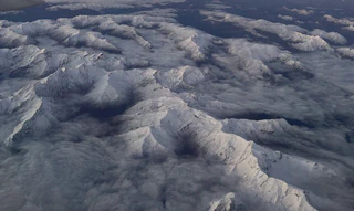
30 Years of Snow Water Equivalent in the Po River District
 Photo credit: John Wani
We are pleased to announce the publication of a comprehensive new snow water equivalent dataset: “30-years (1991-2021) Snow Water Equivalent Dataset in the Po River District, Italy”, now published in Scientific Data.
This dataset addresses a critical need for high-resolution, long-term snow water equivalent data in one of Europe’s most productive and climate-sensitive regions.
The Po River District covers a vast and complex topography, including parts of the Alps and Apennines. Understanding historical snow dynamics here is crucial for water management.
- Time Span: 1991 – 2021 (30 Years)
- Resolution: 500 m (Spatial) / Daily (Temporal)
- Coverage: Po River District (Alps & Apennines)

© 2025 John Mohd Wani. All rights reserved.
Generating consistent data over complex terrain requires more than just interpolation. This dataset was generated by the Waterjade SRL team in a collaborative effort between Autorità di Bacino Distrettuale del Fiume Po and University of Trento using a hybrid modeling approach that integrates:
- Physically-based Modeling: Using the GEOtop model to simulate the snow dynamics.
- Data Assimilation: Enhancing model estimates by assimilating in-situ snow depth measurements and Earth Observation (satellite) snow products.
This combination allows to fill observational gaps while maintaining physical consistency in the snowpack simulation.
Why This Dataset is Unique?
We believe that this dataset fills a critical gap in the scientific understanding of hydrology in the region. It represents an unprecedented piece of information for four key reasons:
- Longest Time Series: It reports the longest time series of coherent SWE maps at daily aggregation in Italy (surpassing existing datasets which typically cover shorter periods).
- Homogeneity: The maps are homogeneous in terms of modeling approach across the full 30 years and the whole domain, which significantly facilitates the interpretation of long-term trends.
- Drought Monitoring: The maps can be used to calculate the SWE anomaly of a given position relative to the 1991–2021 statistical distribution. This is a vital tool for addressing snow drought alerts.
- Benchmarking: It could be used as a high-quality benchmark to validate temperature-index models and other simple models frequently used for operational purposes.
Access the Data
This dataset is open-access and ready for use in climate impact studies like snow droughts, hydrological modeling, and water resource management.
Dall’Amico, M., Tasin, S., Di Paolo, F., Wani, J.M., et al. (2025).
30-years (1991-2021) Snow Water Equivalent Dataset in the Po River District, Italy.Scientific Data, 12, 374.
See the Data in Action
Want to see what this data reveals about snow water storage?
We performed a comprehensive analysis using this exact dataset. Read the key findings in our recent blog post:
